Trekking in 2009: from Bahrabise to Sanghutar
The altitudes shown for the halting places come from a GPS receiver (Garmin GPSMAP 60 CSx).
Available download: the GPS tracks recorded for each stage in the form of Garmin Mapsource files (*.gdb)

In those cases I’m more interested in how many meters we climb and descend.
Saturday, 24-10-2009
Kathmandu - Bahrabise (854 m.) - Karthali (1632 m.)
Log for the section Bahrabise – Karthali:| Start: 11:47 | Duration: 4h28 | Ascent: 771 m. | Descent: 7 m. |
| Highest point: 1631 m. | Lowest point: 864 m. | ||
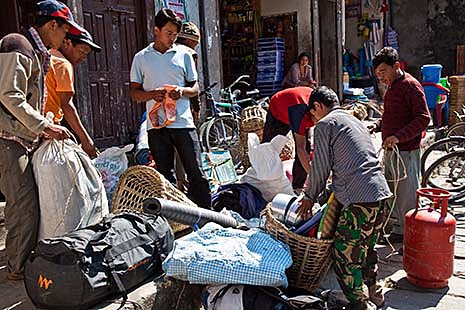
It is always difficult to get even loads, but my staff is experienced and often works together.
My gear is all down on time and I’ve finished my breakfast when Indra comes to report that our car, a mini bus actually, is ready. We drive to Kame’s place where we need little time to finish loading.
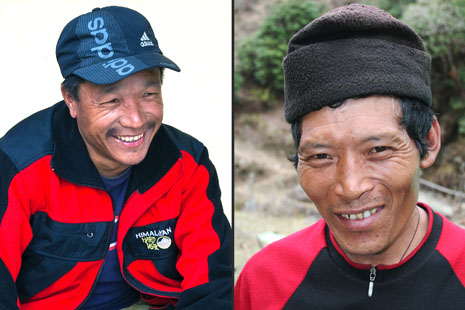
Left Kame Sherpa, right Karma Sherpa.
- Kame Sherpa – guide,
- Karma Sherpa – cook,
- Janbu Sherpa – cook’s hand,
- Kami Sherpa – porter, brother-in-law of Kame the guide,
- Onche Sherpa – porter,
- Saila Tamang – porter,
- Manbir Tamang – porter and
- Sambu Tamang - porter.
Only Onche is a little late but by 8 am we’re on our way.
The drive goes smoothly. When we get to Bahrabise we find that there are very few porters available what should not have come as a surprise really. Kame will have to carry my photography pack as well as his normal load. We have our lunch and set off again at 11:47.
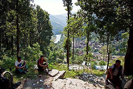
Looking back to Bahrabise. Such a large place we won’t see again for quite some time.
It was my plan to walk to Ghorthali, at about 1800m high, and I’m rather surprised that our climb is so steep and takes so long. According to my map, we should first get a short climb then, when above the river, a gentle ascent followed by a steeper climb on the last stretch.
.... more pictures (5).
Sunday, 25-10-2009
Karthali (1632 m.) - Dolangsa (2736 m.)
| Start: 07:10 | Duration: 8h34 | Ascent: 1170 m. | Descent: 98 m. |
| Highest point: 2674 m. (at 15:43) | Lowest point: 1598 m. (at 07:10) | ||
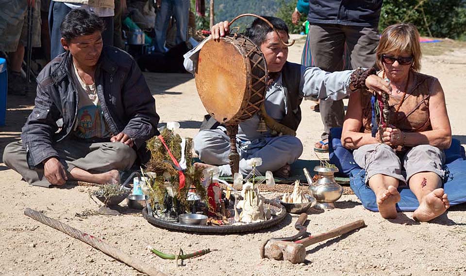
One interesting thing we witnessed today was a complete consultation between a sjamaan (jhankri) and his patient, a western woman.
It was quite a strenuous day today. We covered many steep sections, as well as some 4wd tracks although we tend to avoid those if we see that they are significantly longer.
.... more pictures (24).
The good news is what we climbed today we won’t have to do tomorrow when we go over the Tinsang La which is 3319 m high. However, the section Ruphtang to Bigu Gompa involves a 300 m ascent, thus it won’t be all that easy tomorrow either. The present GPS-altitude is 2736 m.
Monday, 26-10-2009
Dolangsa (2736 m.) - Bigu Gompa (2517 m.), via the Tingsang La (3300 m.)
| Start: 07:09 | Duration: 9h35 | Ascent: 883m. | Descent: 1100m. |
| Highest point: 3300m. (Tinsang La, at 10:02), | Lowest point: 2312m. at 14:44. | ||
Lunch break from 11:23 till 12:30 (1h07).
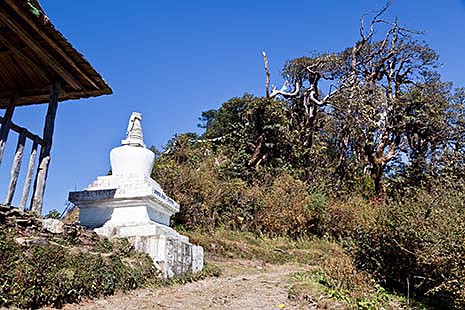
Chorten at Tinsang La. This pass did not stimulate me to take pictures of the landscape around.
The subsequent ascent is long too and the final stretch up to Bigu Gompa is in places quite steep. Just before we get to the camp site near a community lodge (Bigu Komge Lodge) we temporarily lose our way making it even longer.
I decide not to visit the Gompa today. There will be plenty of time for that tomorrow because tomorrow is a rest day. The monastery stands in a beautiful spot. It’s a nunnery that has been very well maintained.
.... more pictures (4).
Tuesday, 27-10-2009
Rest day in Bigu Gompa (2517 m.).
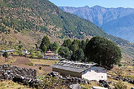
The monastery Bigu Gompa in the landscape.
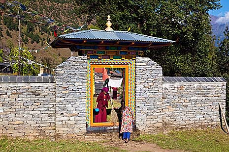
The entry gate to the monastery Bigu Gompa.
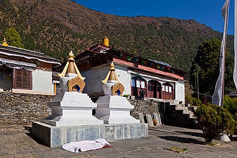
The Gompa. I could resist the temptation for a nap on the mattress.
.... more pictures (36).
It was the plan to sleep till 7 this morning but I was wide awake half an hour before that. Perhaps not surprising when one hits the sack at 8 the night before. After breakfast I stroll to the monastery. Some 70 to 75 nuns live there. The entry gate is in the shade at present so I’ll have to come back this afternoon to take pictures of it. The monastery stands at the foot of a hill which has the sun on it all day. A number of tall trees provide some shade. The garden beds are ringed with marigolds. It’s all very beautiful although a few wall paintings near the entrance to the Gompa are in need of restoration. The entrance with its row of white Chorten is magnificent. The interior of the temple is beautiful too. It’s a pity that photography is not allowed inside. This is one of the few buddhist places where there is such a prohibition.
In the monastery grounds we meet a man who teaches there and has built a greenhouse for growing vegetables. The greenhouse is covered in plastic film instead of glass and the first sowing took place only a few weeks ago. A little foolish perhaps because the nights will soon be too cold for the vegetables to mature properly. However, the motto is: "You may be lucky". We strike up a conversation and it transpires that the man is a doctor who has been here for four month. A bit later we run into him again and we then discover that he is in fact a Tibetan doctor, an amchi. At this Kame mentions that he regularly suffers from pain in his chest/lungs and the man offers to examine him. The upshot is an amount of pills sufficient for 7 days. If they prove beneficial he can visit another amchi in Kathmandu for further treatment. The consultation cost only Rs. 150,-. This whole procedure instils more confidence than the treatment we witnessed the day before yesterday when a western woman was treated by a shaman. However, that procedure was rather more interesting for me and led to a series of nice photographs.
I return to the entrance gate to the monastery during the afternoon when it’s sunlit to take some pictures. I was lucky in that a team of cleaners was active just then which added another note of interest to the pictures.
The day was, of course, also used to wash myself and some clothes. Nor did we forget to connect the solar panel to my Solar Tuki and put them in the sun. Kame made a phone call and managed to hire a couple of extra porters who are to meet us in Jiri. That will mean the end of the extra heavy loads for our cook and porters.
We meet up with a group of Frenchmen who are on their way to Rolwaling. We go the same way as far as Laduk.
During this trip I learn how community lodges operate. A lodge may for instance be owned by the Austrian Alpine Club but be operated by a local under a leasing arrangement.
Wednesday, 28-10-2009
Bigu Gompa (2517 m.) - Chilanka (1804 m.)
| Start: 07:11 | Duration: 7h46 | Ascent: 432 m. | Descent: 1104 m. |
| Highest point: 2495 m at 14:17 | Lowest point: 1594 m at 09:45 | ||
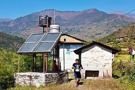
Lodge in Loting, our lunch place. The lodges on this route to Rolwaling are build by the Austrian organisation EcoHimal and offer all hot water for showers, produced by solar collectors.
From the above data it’s clear that it was not a difficult day. Still, we went down quite steeply and going up got me puffing. Kame took pity on me, it seems, because he offered to swap backpacks with me. His seemed to be quite empty.
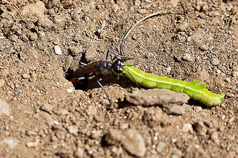
At the place in Loting where we stop for lunch, near an unoccupied community lodge, I spot an ichneumon wasp with a large green caterpillar in tow. I follow the insect for about 3 to 4 metre and am amazed to see that even over such a distance it unerringly finds the place where it has already dug a hole into which the caterpillar gets deposited after which the hole is carefully filled in and camouflaged.
During our last break before reaching Chilaka, Kame lets the photo backpack accidentally slip from a low wall. Immediately on our arrival I check whether there is any damage. Luckily, both laptop and camera survived unscathed.
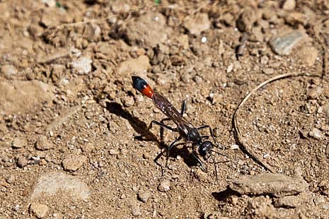
So, nobody can see that here a brood cell is filled.
Thursday, 29-10-2009
Chilanka (1804 m) - Laduk community lodge (2060 m)
| Start: 07:17 | Duration: 4h50 | Ascent: 555m. | Descent: 301m. |
| Highest point: 2046 m at 14:27 | Lowest point: 1789 m at 07:19 | ||
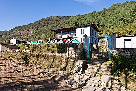
Laduk Community Lodge
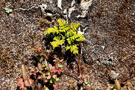
Just a stone on which plants have a difficult and specialized life.
.... more pictures (7).
During lunch, I eat something that they call kendalo here and that I haven’t had before. It is a tuber that is boiled and tastes a bit like potato.
Later on, in Duble, I hear it referred to as karkalo for which there is a reference in Wikipedia. It is actually the plant Colocasia esculenta, usually called taro. In Nepal, they call the corm pindalu and the leave stalks and leaves Karkalo or gava. Every part of the plant is eaten. I took a tuber from Duble home with me and planted it in my own garden.
I do not sleep as well as usual. I dream that I am in a building and that it takes me ages to find a way out. However, I only have to get up once for a visit to the toilet. It’s quite noticeable that we are at a lower altitude – the sleeping bag is warm indeed.
It was a very nice trip today. For the first time, there was no cloud in the sky and only once was there a climb that was literally breathtaking. For the remainder it was so-called "Nepalese flat".
Since we are staying the night I can erect the solar panel and charge the Solar Tuki.
With our party as well as a group of Austrians the camping is quite full. The leader of the Austrians happens to be the project leader responsible for the construction of a series of eco-lodges in this area. All these lodges have solar hot-water systems for the showers.
Friday, 30-10-2009
Laduk community lodge (2060 m) - Suri Dhoban (1021 m)
| Start: 07:30 | Duration: 5h50 | Ascent: 42 m. | Descent: 1025 m. |
| Highest point: 2039 m at 07:30 | Lowest point: 1051 m at 10:59 | ||
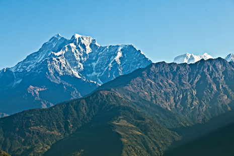
The Gaurishankar, before the descent to Damonee
After lunch we walk for just half an hour before reaching Suri Dhoban. The walk goes through a valley that in places is so narrow that there is no GPS reception.
During the walk, Kame receives a phone message to say that his uncle the Lama has fallen seriously ill and that his wife is going to Duble. The children will stay in Kathmandu and will have to look after themselves for some of the time.
We camp close to where the Suri Khola enters the Bhote Kosi. The river is about 15 m below us. There is regular passing traffic of donkey caravans which come from the direction of Rolwaling and seem to carry no freight.
The name Suri Dhoban is not all that strange because Dhoban means 'confluence of rivers or valleys' and it is here that the Suri Khola and the Bhote Kosi and possibly other rivers meet.
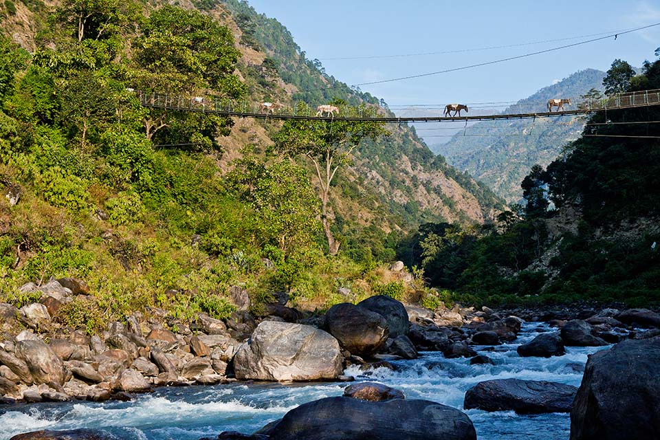
Suspension bridge in Suri Dhoban over the Suri Khola.
.... more pictures (25).
Saturday, 31-10-2009
Suri Dhoban (1021 m) - Dandakharka (2017 m)
| Start: 06:58 | Duration: 9h01 | Ascent: 1139 m. | Descent: 156 m. |
| Highest point: 2036 m at 15:59 | Lowest point: 1039 m at 07:21 | ||
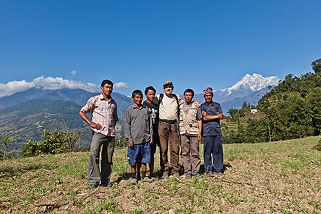
My helpers with the Gaurishankar in the background. Kame, de guide, and Garma, the cook, are missing. Kame took the picture and Garma is already far ahead to prepare for the next camping place.
.... more pictures (4).
On arrival in Dandakharka I copy the data from the GPS to the laptop. Only just in time too because the memory was for 99% full. We camp in a deserted school ground. Tomorrow we’ll continue Serukapti, then to a pass at 2760 metre and subsequently down to Jiri via Dhunge. There will be an ascent of some 750 m to the pass.
Sunday, 01-11-2009
Dandakharka (2017 m) - Jiri (1929 m)
| Start: 07:18 | Duration: 7h20 | Ascent: 806 m. | Descent: 979 m. |
| Highest point: 2708 m at 11:16 | Lowest point: 1936 m at 14:34 | ||
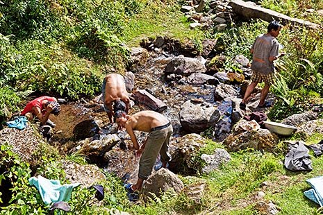
We approach Jiri, so time to do some sort of washing.
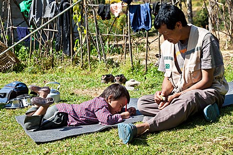
Under supervision of Kami Sherpa, her uncle, Yangyi makes homework. She should have been at school, but assume that it is acceptable that she misses the exams, at the Kindergarten.
On arrival in Jiri almost all I remember of the trip is that it was very strenuous indeed. Especially the long descent after crossing the Danda (according to the map the Hanumante Danda, but Kame calls it the Jiri Danda) before finally getting to a suitable place for a lunch break near a small river. I had difficulty squatting down to wash my hands in the river.
In Jiri we meet up with Kame’s wife Daputi and daughter Yangyi. Daputi is on her way to Duble because Kame’s uncle, de lama, is seriously ill and the aunt, who normally manages all affairs, could use some help. There are also 2 young boys. One of them will go with Daputi to Duble as fast as possible while the other one, called Tendi, will take over as porter for my photo backpack. Tendi is the same age as Furi, 17. Yangyi will probably come with us.
From now on I leave the choice of route entirely to Kame as long as it’s not too hard for me. Going via Goli Gompa is entirely out of the question. In fact, I find the ascents much harder than I had anticipated, but a couple of more average passes should cause me no problems.
For the route after Duble I opt for walking to Sanghutar, where we can take the bus to Manthali or Khimtibesi, from where we can be picked up by a Multi Adventure 4WD.
Monday, 02-11-2009
Rest day in Jiri (1929 m)
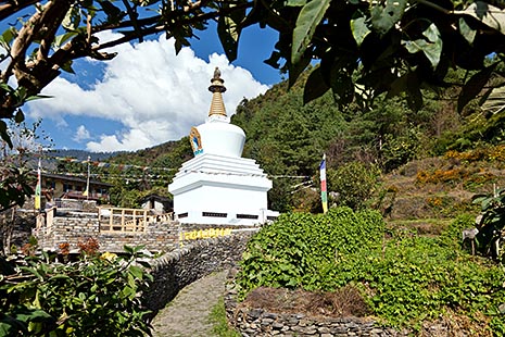
A new chorten in Jiri.
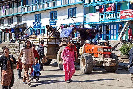
Jiri still is a hub full of activity.
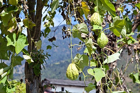
The chayote (Sechium edule), is called Iskus in Nepal. It is a healthy and tastefull vegetable.
The GP-batteries for the GPS have been recharged, but the 2 that are in the GPS now appear to be faulty because even after hours of charging they are still not full. I hope that this is merely caused by the many power interrupts during the charging process. I decide not to buy a 12 V DC - 230 V AC converter. That would set me back about 50 Euro. If I’m careful I probably won’t need it. Kame sold his converter together with his TV and DVD-player and the unit we used last year is no longer working. Anyway, there is no converter available in Duble. If I manage to charge the laptop battery here in Jiri then that should be enough to copy the photos and GPS data to the laptop and external hard disk. I’ll have to watch it closely. The reviewing and selection of the photos will have to wait till Kathmandu and Chitwan or even until I get home.
I had originally planned to follow the trek with a 2-day stay in Pharping where I would spend the night. Another possibility now occurs to me. Since we have to travel via Kathmanda in any case, it is just as easy to book a room in Multi Adventure’s Kathmandu View Hotel and to take a couple of day trips to Pharping. That is probably no dearer than a one-night stay in Pharping and has the advantage that I’ll have local transport laid on. I’ll ask Kame to organise things with Multi Adventure; he’ll have to call them anyway to discuss the return alternatives Manthali/Khimtibesi.
Kame has bought a double adapter that fits into a lamp socket. These things are banned in Holland but they are quite handy. It allows me to recharge the laptop’s battery as well as other ones via a socket in the kitchen shed.
I take an afternoon stroll through Jiri. It is still a central services community. In one of the shops, Yangyi spots a plastic child seat that she particularly likes and she manages to get her way with Kame. It costs him Rs. 400,-. Yangyi carries the little chair herself all the way to the camping which lies behind Namaste hotel. This hotel looks still just as dilapidated as during my previous visits.
Jiri’s position between the mountains is such that the sun sets at about 4. By 5 o’clock it’s quite cool. Too cold to sit quietly and write. The mother hen and chicks that had the run of the place during the day have been caught and put inside. The 4 little goats grazing in a field next to the camping are also moved into a stable.
.... more pictures (9).
Tuesday, 03-11-2009
Jiri (1929 m) - Shivalaya (1786 m), via Those
| Start: 07:41 | Duration: 7h00 | Ascent: 407 m. | Descent: 531 m. |
| Highest point: 1971 m at 10:04 | Lowest point: 1685 m at 11:20 | ||
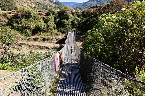
The suspension bridge over the Khimti Khola close to or in Those. The river is the border between the districts Dolakha and Ramechhap. Yangyi on the bridge.
Approaching Shivalaya.
Yangyi keeps up well. Especially early on she keeps the pace well even though for her that almost means going at a trot. When it gets too steep Kame carries her.
In Shivalaya we stay at a different camping from the one I stayed at with Annette. It’s about 50 m further from the river (Khimti Khola). You reach it via a shortcut past the police station. The village has changed very little since I was here with Jan last year. At the lodge I enquire after the micro-fibre towel I had left behind there although I don’t rate my chances. I spend about an hour, armed with the telephoto lens, on the banks of the Khimti Khola in the hope of capturing one of the redstarts that were so prolific there last year. No luck.
.... more pictures (10).
Wednesday, 04-11-2009
Shivalaya (1786 m) - Bhandar (2217 m), via the Deorali pass (2718 m)
| Start: 07:11 | Duration: 7h45 | Ascent: 938 m. | Descent: 498 m. |
| Highest point: 2663 m at 13:29 | Lowest point: 1753 m at 07:11 | ||
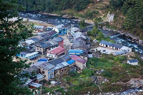
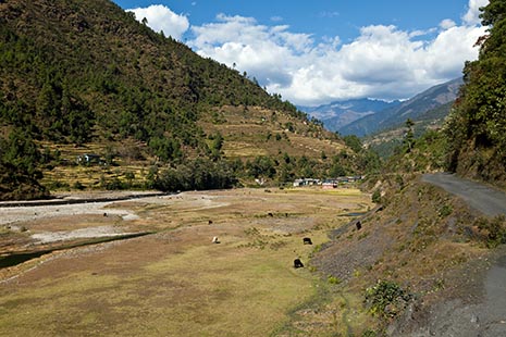
looking back to Shivalaya
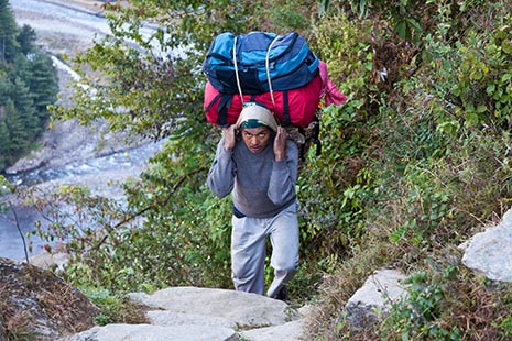
Saila with his load on the steep first part of the track leaving Shivalaya.
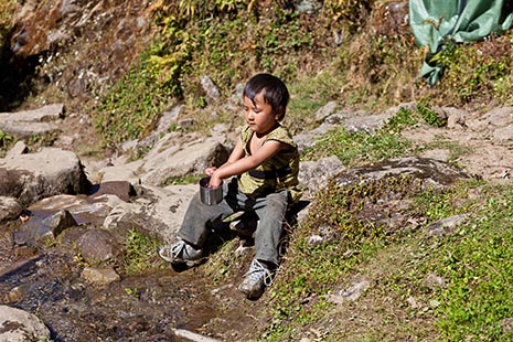
While the lunch is being prepared Yangyi plays with the water.
This morning I got my gloves out of the pack for the first time. When I got up at 06:00 it was 7.5 degrees C according to my travelling alarm clock. Even during the strenuous work of the first part of the day the gloves were very welcome. After the first steep climb of about an hour we get to some level stretches. Notwithstanding the increase in altitude, I don’t feel tired. Perhaps this is due to Yangyi’s presence which may have reduced our tempo a little. I’m quite impressed by how she, at Kame’s hand, climbs and walks. Of course, she’s also carried a lot.
Karma has found us a beautiful place for our lunch stop. Still about 150 m below the pass and by the side of a river near a water mill.
In the pass, I diligently photograph all those things that I skipped last year. The descent to Bhandar is a copy in reverse of the trip I did with Jan last year, except that this time we make a short stop just past the new village centre of Bhandar, at a rather large but uneven grassed area. The sun disappears behind the mountain range, the Deorali, at 16:10 en it’s time to put the fleece on.
In consultation with Kame, I decide that we will not go via Goli Gompa. In the evening there use to be clouds in the direction of the Gaurishankar, and one of the reasons for going via Goli Gompa is to take pictures of the Gaurishankar lit by the setting sun. To be honest, the thought of first descending 800 m to the river (Likhu Khola) and then to ascend 1500 m does not appeal to me. And there is every chance that we will get a good look at the Gaurishankar from one of our later camp sites.
The memory of the GPS receiver is after 2 days for 74% full. Thus it turns out that I need the laptop more to store GPS data than to keep photos. The photos can be kept on a series of memory cards, whereas the GPS data are stored in the internal memory of the GPS receiver that cannot be changed or expanded. So, into the tent to do some work. I did remember to take a picture of the GPS display showing the time. There is evidently a difference of between 1 and 2 seconds between the times from the camera and the GPS. Not enough to warrant a correction.
.... more pictures (14).
Thursday, 05-11-2009
Bhandar (2217 m) - Kapte (1761 m)
| Start: 07:19 | Duration: 7h43 | Ascent: 550 m. | Descent: 965 m. |
| Highest point: 2182 m at 07:19 | Lowest point: 1435 m at 09:22 | ||
Peepal Dada in Roshi, our camping place last year. Gaurishankar in the background.
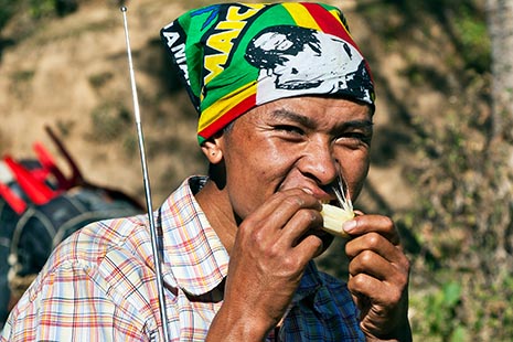
Not only Manbir Tamang, but everyone is chewing sugar cane.
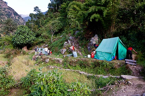
The camping place in Kapte. We do not need much space.
.... more pictures (4).
By crossing the Likhu Khola we leave the Ramechap district and enter the district of Okhaldhunga. The ascent isn’t easy but luckily not very long. After only 40 minutes we reach the lunch site at the lodge. The water mill that used to stand there has disappeared. Dorje Sherpa, the owner of the lodge is also in the electricity generation business. He operates two privately owned water turbines. One with a pipe head of 75 m and a capacity of 3KW and another with a capacity of 5 KW, having a thinner pipe with a head of 130 m. The distribution takes place via an insulated cable with 6 copper strands each with a diameter of about 1.5 mm. This is a very inflexible cable and I didn’t know that this type was available in Nepal. With this cable there is no voltage drop to speak of. The customers have no electricity meters but instead pay on the basis of the number of devices that are connected. Connecting a 25 Watt lamp costs Rs. 25 per month. Most customers have from 2 to 4 of these lamps and would therefore be paying from 50 to 100 rupees a month.
Each house is fitted with a lightning protector which also serves for grounding the network. Dorje Sherpa also has a biogas installation that produces sufficient gas for lighting and heating his house. It is a simple installation, comprising a concrete tank with a manual stirrer, in which the manure of 5 cows/buffaloes is fermented by the simple addition of water. The residue is used on the land as fertilizer.
There is a small group of scientists in the village carrying out an environmental impact study in respect of a planned hydroelectric power plant. One of the scientists is off sick with a slight fever which gives me a chance to talk to him. He tells me that there are plans to drill tunnels through the mountains to transport the water to the plant and that Chinese companies are being contracted for this work. The quality of the rock to be tunnelled through is such that the tunnels will need to be lined with concrete over short distances only. Al the required materials will be brought in by helicopter. The project should be completed in 3 years. There are obviously going to be some drastic changes around here.
I also have a conversation with a Korean girl I meet on the terrace of the lodge. She manages a library in the next village higher up the mountain. She has no electricity there for her laptop so has to come down here for that. A 2 hour walk down and another 3 hours back up. She spends more time recharging her laptop than using it. As a result she only used it to store her photographs. However, she does in this way regularly spend a pleasant day with the Dorje Sherpa family.
I did not climb a lot this day, but strangely enough I feel quite tired on arrival at the camp site. When I arrive everybody is chewing on pieces of sugar cane and I join them. The GPS and watch see virtually eye to eye over the altitude, 1762 and 1768 meters respectively. The tents are erected on a small terrace that is currently not in use and not far from a residence. It’s a bit makeshift. That I’m tired is possibly also due to the fact that I had trouble sleeping last night but decided not to take a sleeping pill. I usually get into my sleeping bag between 7 and 8 which means that the nights are long indeed.
Friday, 06-11-2009
Kapte (1761 m) - Pulika (2362 m)
| Start: 07:18 | Duration: 3h45 | Ascent: 755 m. | Descent: 150 m. |
| Highest point: 2365 m at 11:03 | Lowest point: 1759 m at 07:18 | ||
My writing is interrupted by an uproar nearby. A couple of people are running up the hill while screaming and shouting. I then spot 2 birds of prey flying away from the area and out to the valley. One of these birds had attacked a chicken. Although injured the chicken survived the ordeal.
At sunset I busy myself photographing the mountains. Karma promises that tomorrow night’s views will be even better.
Saturday, 07-11-2009
Pulika (2362 m) - Charnal (2691 m)
| Start: 08:13 | Duration: 6h04 | Ascent: 584 m. | Descent: 267 m. |
| Highest point: 2689 m at 14:20 | Lowest point: 2346 m at 08:15 | ||
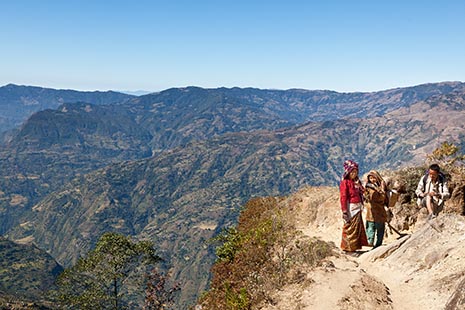
Landscape between Pulika and Charnal.
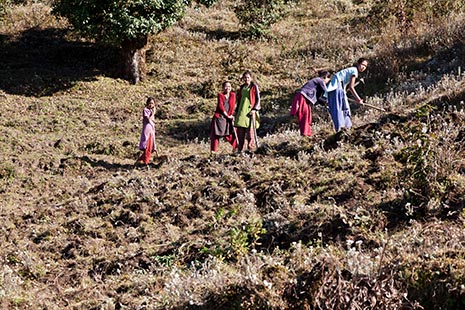
This is a spot for potato planting.
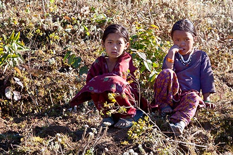
All our moves are being observed.
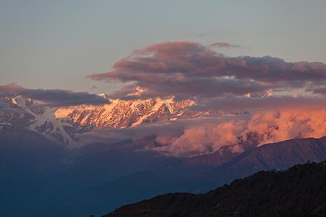
Gaurishankar at sunset, as seen from Charnal.
.... more pictures (26).
The first two hours the ascent is not too strenuous but after that it becomes quite an effort. My condition must be a lot poorer than last year or the climb is a lot steeper here than I’m used to. I suspect it’s the former and perhaps also that the recovery after the radiation treatment takes longer than I had hoped.
We camp in a field a little distance from the village. A bit higher up a group of women is working the land where potatoes are to be planted.
Some of this track I also walked along in 2000 together with Annette when we were travelling from Chuplung Banyang to Digarpu. I take some pictures of the house near where we camped then. The night we stayed there will always be remembered as “the night of the storm”. Of the track itself I remember little. There are some features that catch the eye but to be honest they could have been anywhere.
On arrival, the Numbur and the Gaurishankar are clearly visible and I tell Kame that I expect to be able to take the wanted pictures at sunset tonight. And if it’s clear at sun up as well that would be ideal. There will then be no need for a rest day tomorrow. The rest of the way to Duble has few ascents. The locals do it in one day but I’ll need two reasonably short days. However, at 5 o’clock, some clouds appear in front of the mountains and it doesn’t look as if they will disappear before sunset. It’s a good thing that I took the pictures I did yesterday rather than gambling on the better views in Charnal. Even though the clouds continue to hang around, I manage to get some quite nice shots of the sunset.
A complication crops up that evening. Karma reports that he’s almost out of cooking gas. He’ll have to go over to using wood fires soon. Another reason to get to Duble sooner rather than later.
I transfer the GPS data and almost 8 GB of photos to the laptop and back-up external disk. Reading the CF cards seems to take for ever even though I use reasonably fast cards (Sandisk Extreme III of 30 MB/s). I can’t wait for a faster reader to be brought on the market.
However, there is a better option these days when it comes to backing up to a hard disk, namely the use of eSATA and eSATAp connections and an SSD. During longer treks, it’s advisable to store the pictures on memory cards and reserve the laptop for storing the GPS data. At the end of the process, my battery has an hour’s use left in it.
Sunday, 08-11-2009
Charnal (2691 m) - Chuplung Banyang (2592 m)
| Start: 07:20 | Duration: 4h15 | Ascent: 366 m. | Descent: 380 m. |
| Highest point: 2705 m at 07:43 | Lowest point: 2338 m at 10:28 | ||
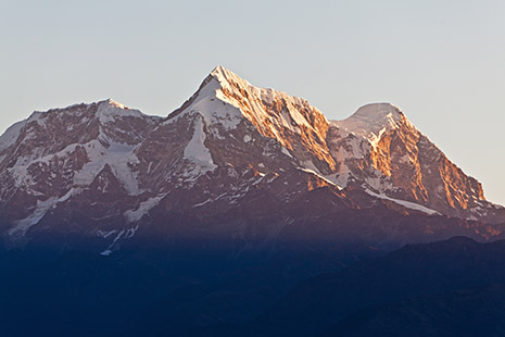
Gaurishankar at sunrise.
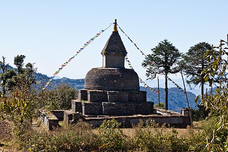
the stupa of Chuplung Banyang.
For much of today we’ll be following the same route as I walked with Annette in 2000 but in the opposite direction.
Notwithstanding the fact that Kame drops in on an acquaintance for a cup of tea, and in fact suggests that we all have our lunch there as well, (even though it’s only just after nine, so that I refused), we reach the Gompa before 12. There I consumed Karma’s lunch at lunch time.
Actually, we only stop in Chuplung Banyang because there will be electricity here tonight to recharge my laptop.
It’s very dark inside the Gompa and the tripod comes in handy indeed. I take all pictures without flash and make sure that the image stabilizer is turned off.
Classes are in progress outside a small school next to the Gompa. A few monks walk past on their way to a wake held a bit further up. They will also conduct the cremation ceremony that will take place tomorrow. We will walk past the house of the deceased tomorrow.
I have a lovely lazy afternoon. I can do my photography completely at my own pace. Tonight, after 6, we’ll be able to charge the laptop somewhere but that will mean that it will be late before I get to bed. Last night it got late as well – about 19:20.
.... more pictures (28).
Monday, 09-11-2009
Chuplung Banyang (2592 m) - Thare (2317 m)
| Start: 07:37 | Duration: 5h54 | Ascent: 464 m. | Descent: 708 m. |
| Highest point: 2591 m at 07:37 | Lowest point: 2065 m at 10:17 | ||
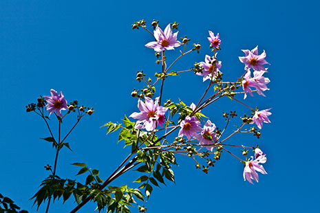
Dahlia.
I get some more tips about Nepalese pronunciation. For instance, the porter who worked for Anita and me last year in Helambu, was not called Naati, but Nauti, which is very difficult to say because there is a bit of the aa in it as well. Furthermore, the youngest person of a group of people is called Naati. Thus in our party we have Tendi Naati and Yangyi Naatini. [I am Baje].
As we walk passed the house of the deceased we notice that relatives are busy outside with the assembly of a stretcher. The cremation will take place this afternoon on top of the mountain ridge. A bit further, we pass a couple of men who are on their way to the ceremony. One carries a jug of chang and the other a teapot with raksi. We also see some red berries, of which Kaji told us in Helambu that they are only used as a lure for birds. However, Kame now tells me that there is a bird that is not only attracted to the color of the berries but also actually eats them.
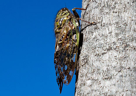
A cicada. You hear them often, but see them seldom.
I also take some pictures of some dahlias in someone’s garden and the owner invites me inside for a glass of milk.
It hasn’t been a difficult day but one had to stay alert at all times because much of the walk was along the edges of terraces. We find a beautiful camping spot on the top of a hill from which we can already see Duble and where there will be a stupa next year.
My Nepalese crew finds it rather odd to camp out another night so close to our destination. They could be there within the hour while it would take me about 2.5 they reckon. For me the advantage of camping here is that I need not come back at some later date, for the panorama shoot of almost all of Duble that I want to do from this point. At the moment, we look against the sun but I hope that early tomorrow morning the hillside will be bathed in a beautiful light and without too much of a blue haze.
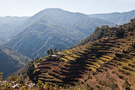
The slope with the major part of the houses of Duble. Tomorrow morning I will go to the house in the upper right part for taking pictures to be used to construct a high definition panorama.
.... more pictures (7).
Tuesday, 10-11-2009
Thare (2317 m) - Duble (2263 m)
| Start: 07:53 | Duration: 4h12 | Ascent: 292 m. | Descent: 336 m. |
| Highest point: 2370 m at 08:02 | Lowest point: 2094 m at 09:41 | ||
I start the day by taking a few pictures from the hill top where we camped. Then I go to the house on the projecting point I discovered yesterday. The house belongs to Dan Bahadur Tamang. From there I do the panorama shoot. Five series of about 10 exposures each. That should be enough to do something with.
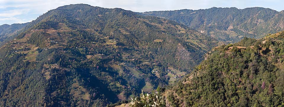
34.821 x 13.192 pixels are used for this panorama.
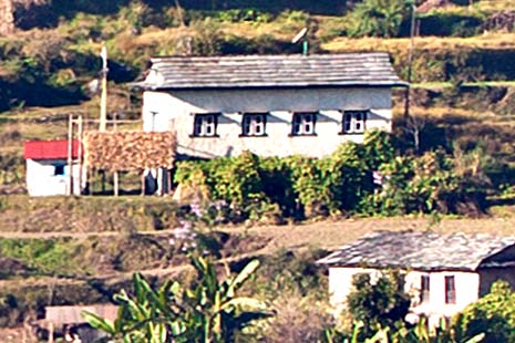
Detail of 465 x 310 pixels taken from the panorama.
I therefore also make one a bit smaller, of 22.547 x 8.705 pixels, which could still easily be printed as a 1.5 m poster.
Of this smaller version, I’ve also made an image for viewing on this website. Using the scroll wheel and the command buttons you will be able to zoom in quite a lot.
This panorama of Duble will be viewable here for as long as I don’t need the web space for items that are more important to me.
.... Panorama of Duble
The panorama shoot is followed by a route through the forest and to the path proper, which involves quite a bit of creeping and crawling. At one stage, on a steep descent through some shrubs, I unexpectedly step into a hole and lose my footing altogether. Luckily there is no damage done.
In the afternoon I take a rest and sort out my clothes that need to be washed. I don’t do the laundry straight away because the wash house is quite busy already and tomorrow I won’t have to do it myself.
Pictures of the arrival in Duble (12).
For the description of the stay in Duble I will now revert to a summary. The many details in the diary will only be interesting for a few readers.
Stay in Duble in 2009
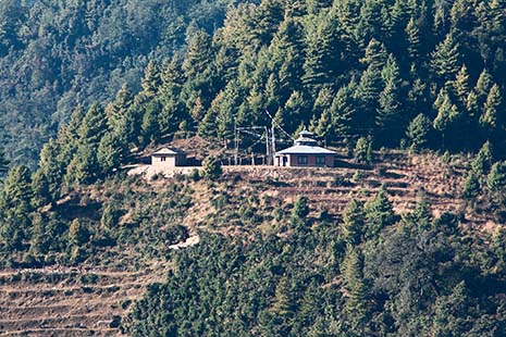
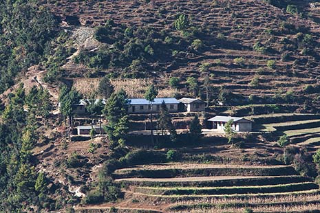
In the small building, left, are the toilets. I cannot wait to tell you that they were tidy and very well maintained. A few yards from the building is a water tap. One of these toilets was funded by Wouter ter Braek.
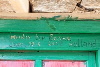
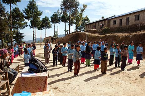
Next day, the welcome celebration is an especially thorough affair. The appointed time is 10 o'clock. So, everyone is present at eleven. Much has changed in eighteen months time. Not only is there now a building with a meeting room, but more importantly, with support from 'Stichting Sherpaland', the classrooms got wooden floors, doors and windows. The corrugated iron sheets on the roof are a gift from a british sponsor.
After a short time in the meeting room we move outdoors with some tables and chairs. The children have assembled in the playground and recite a text in Nepali. Then follows a lively event, in which the guests are honored with garlands of flowers and khatas. Of course, the speeches are not lacking. In these speeches gratitude and the hope for further assistance in the future is expressed.
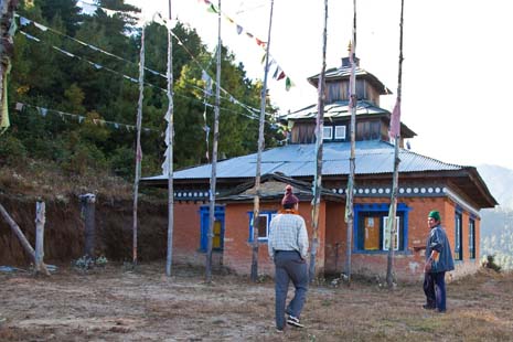
In the gompa people are praying, sharing the latest news, having fun and enjoying a meal.
Pictures made during the puja in the Gompa. (22).
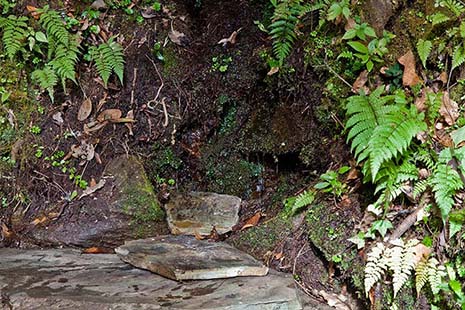
Next morning, Nang Sere Sherpa, Homraj Tamang and Kame Sherpa proudly show me the Pakhe drinking water project that was completed two months ago. The villagers have constructed this water supply with the financial support of 'Stichting Nijmegen Sherpaland'. What surprised me was that rather than taking the water from a stream and putting it through a filter the water is taken directly from a few small wells in the jungle.
Here you see the highest well. From there the water is led, by pipes, to an assembly point 65 meters lower. From that point a wider pipe brings it to a large concrete buffer tank, which is 42 meters lower. Near this buffer tank is the first of 12 outlets. The lowest faucet, I have seen, was located 155 meters below the level of the buffer tank.
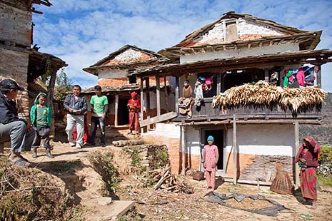
Pictures made in the forge. (8).
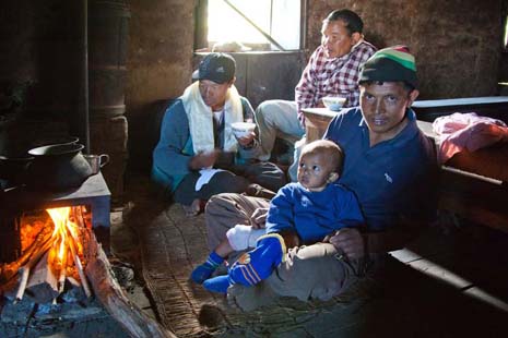
Saila and son visiting Rinji Sherpa, the father of Kame.
Saila has been in my trekking staff for many years, but only now I learned that his official name is Bir Bahadur Tamang.
Finally, I could attend to the activity that was the most important to me - I visited almost all the people, who received one of our stoves or one of our solar panel installations.
I observed that the stoves worked well. My cook, Karma Sherpa, felt that there was only one disadvantage, namely that children more easily burn themselves at the stoves than at the open fires. They have to learn that the stove as well as the stove pipe, can be hot even when you see no fire. The 21 watt solar panels also meet the requirements very well. They are usually used with fluorescent tubes of 10 watts. LED bulbs are more expensive and the standard models are not as suitable for lighting rooms.
During my hike I successfully used a homemade Solar Tuki that I left behind when I left Duble. I wonder how the recipient will rate it. The standard Solar Tuki includes two lamps with 12 LEDs each and a lead battery. Mine has two blocks of six rechargeable NiMH batteries, without charge controller, and a single lamp with two groups of 30 LEDs that can be switched on and off separately.
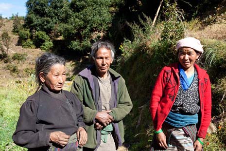
Daputi Sherpa and her family
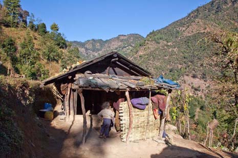
The house of Khadka Bahadur Tamang and his family. He lives here as a tennant, owning no land himself. The nepali used the word 'homeless' for this situation
Only at a few places did I take pictures inside the houses, because in most cases, you can only go inside and stay for any length of time when there are older people. The young tend to work somewhere outside on the land or even outside the village in the trekking industry. For many houses I recorded the GPS coordinates.
Pictures made with the people, who received a solar panel or improved stove from Stichting Milijuli. (14).
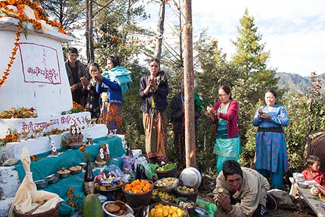
I decided not to join, because the chorten was 300 meters higher and on coming back the washing time would be over. Because the batteries in Kame's camera were almost empty, I gave him my camera. So, the following pictures were made by Kame Sherpa.
Pictures made during the inauguration of a chorten. (10).
Sunday, 15-11-2009
We continue the trek.
Duble (2263 m) - Bhotechaur (2203 m)
| Start: 08:12 | Duration: 5h45 | Ascent: 572 m. | Descent: 619 m. |
| Highest point: 2550 m at 13:09 | Lowest point: 2140 m at 08:58 | ||
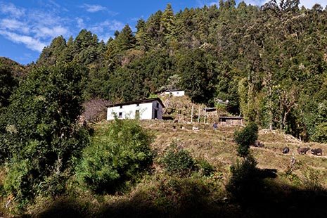
We walk along the Yalun Khola and here we go by the last houses of Duble, close to the border with Laktawari. Here live, in the lower house Bim Bahadur Tamang and a little bit higher Santa Bahadur Tamang.
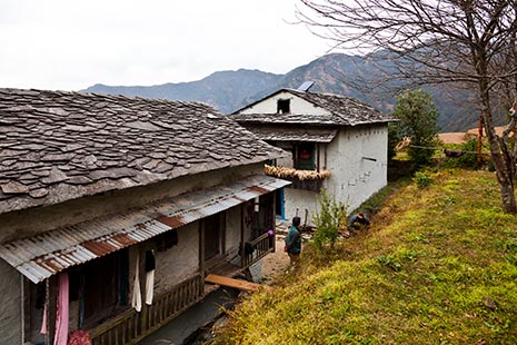
Here lives, in Bhotechaur, Lama Kusang and his family.
We’ll be leaving Duble today. Yangyi isn’t too pleased at the prospect to leave the village because she is having a really good time with all her friends.
From above statistics it isn’t apparent that I had a hard time of it for some of today. A bit after Nayaban there was a very steep section where the GPS gradually lost contact with the satellites. I was very glad when we had that behind us and that we could sit down for our lunch some ten minutes later.
We lunched at the house of a friend of Kame. This friend is a cabinetmaker and was in the process of making a planer. He is one of the few with two wives. During the lunch there is a lot of talk about pico-hydropowerplants. The documents that Kame’s friend shows us are in Nepalese but I spot a number of acronyms used for the government bodies involved, e.g. MGSP, AEEC, AEPC and ESAP (Energy Sector Assistance Program) as well as a logo with the text “Increasing Access to Rural Energy Solutions”. Using these terms I should be able to find some relevant material on the internet.
The rest of the route wasn’t too bad. In fact it was a nice day even if a bit cloudy and windy. This route is lower than the one I walked with Jan in the opposite direction, and has been chosen because it is supposed to be safer for me. The alternative route can be very slippery early in the morning.
We reach Bhotechaur well before Daputi does, because she of course has to visit a sister, who lives nearby.
We camp in Bhotechaur and again near the house of Lama Kusang who it turns out is Daputi’s brother. We’ll have a rest day tomorrow, mainly so that Daputi can spend a day with her brother and her father. Her mother isn’t mentioned at all.
The sunset is rather disappointing and I take no pictures of it.
Monday, 16-11-2009
Bhotechaur (2203 m)
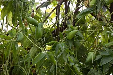
This vegetable was called korella. It doesn't need cookin to eat.
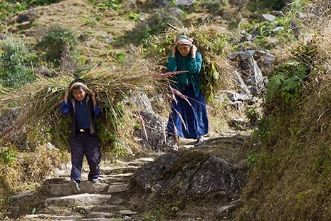
Bundles of grass for the cattle at home.
.... more pictures (6).
I take pictures of one of the korella, the oblong fruits that grow on a vine and which you can eat raw. Just after 9 o’ clock I, together with Kame and Lama Kusang, set off for the Gompa. A few other people join us en route. The lama it turns out has brought the wrong key so there is a delay until the right one has been fetched. Daputi has gone to visit her father and Yangyi keeps on asking for her.
The Gompa is still under construction. There is a building but the interior is far from finished. The walls haven’t been rendered or painted. The prayer books that are so abundant in Duble seem to be completely lacking here or else they are kept out of sight. I take a few overview shots and repeat the process after some butter lamps have been brought in and lit. I make a Rs. 2000 donation to the Gompa and also ask Kame to add to that the fee that we would normally have had to pay for a camping site. Then we go back.
The community of Bhotechaur would like to build a watermill but still needs a lot more money. I promise Kame that after my return home I’ll send them 350 Euro which should cover the cost of at least the turbine and the water supply duct.
After lunch I spend some time airing and inspecting my sleeping bag and sheet bag. This because I spotted some small blood spots on them. However, I fail to find any biting insects.
Manbir and Saila have set off to do some work. Saila armed with a hoe and Manbir carrying a large-as-live kukuri. Kame has slipped into his tent for a siesta. I first photograph a group of marigolds and stroll around a bit before I follow Kame’s example and retire to my tent to get some shut-eye.
Tuesday, 17-11-2009
Bhotechaur (2203 m) - Ghorakhori (1401 m)
| Start: 08:41 | Duration: 5h37 | Ascent: 204 m. | Descent: 932 m. |
| Highest point: 2296 m at 08:41 | Lowest point: 1392 m at 13:35 | ||
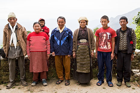
The group portrait. At the right Gombu.
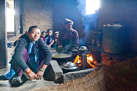
Gombu does not have an improved stove yet.
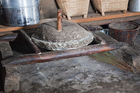
Bhotechaur still lacks a watermill.
.... more pictures (8).
Daputi’s father has come to lama Kusang’s house to bid us farewell at our departure. This of course demands the taking of some group portraits. Unfortunately the light is rather poor. Daputi’s father then accompanies us to Gombu’s home. There the Nepalese crew is presented with a farewell breakfast. As their dish is deemed to be too tart for me I’m first handed a bowl with 5 boiled eggs; Yangyi’s helps me by eating one of them. This is followed by a plate with rice and milk. I had hoped to leave one of the eggs on my plate but before I know what is happening, Janbu has been so good as to shell it for me and add it to the rice. I’ve never drunk as many glasses of milk as I have recently. I also accept a small glass of Raksi. It actually seems to have no specific taste at all just like young Dutch gin. However, one usually sees some floating objects in it such as burned grains of rice. Raksi is usually served warm and then with some butter floating on top so that the alcohol doesn’t evaporate so quickly. Raksi is generously served at all festive occasions and any sherpa who is not a teetotaller is liable to imbibe quite a bit.
As promised, the descent is quite gradual and takes us along a road under construction allowing for a pleasant walk. This road didn’t exist yet when I was here with Jan last year and the path we took was a lot higher up on the side of the hill.
We spot a large grey monkey on the slope above us. According to Karma it is a male and could be dangerous. They have been known to attack solitary travellers. We also come across two marten-like animals. They are as large as a decent sized cat, with a black front and rear and brown in the middle. Kame says that they steal chickens. Their Nepalese name is Malsapra. In my animal textbook I later discover their proper English name: Yellow-throated Himalayan Marten. They have a beautiful long tail with thickset black hair.
It was probably not really necessary but faced with a very long hairpin stretch in the road it was decided to take a shortcut. After we crossed a small river, the track became so steep that Kame stood above me ready to pull while Karma was ready to push me from below. However, I did just manage to get up by myself but that short stretch really took it out of me. Luckily the camping was not far from there. Actually, camping was not quite the right name for it because it was just a small level piece of ground in front of the tea shop of the daughter of lama Kusang. That daughter manages the shop with the aid of her brother’s wife. Both women have a child that attends the nearby school. When their husbands went in search of work abroad, one in Italy the other in Dubai, the women moved from Kathmandu to the country because the cost of living is much lower there. I am told that the lama’s son went to Poland first on a student visa and then to Italy to look for work there. Apparently he has a part time job there now.
The village Ghorakhori is not much to look at. It’s untidy. The neighbouring fields have only recently been sown. The name of the town is pronounced Chaurakori.
Wednesday, 18-11-2009
Ghorakhori (1401 m) - Sanghutar (554 m)
| Start: 07:21 | Duration: 6h52 | Ascent: 336 m. | Descent: 1130 m. |
| Highest point: 1532 m at 09:42 | Lowest point: 667 m at 14:13 | ||
Lunch break in Kopani.
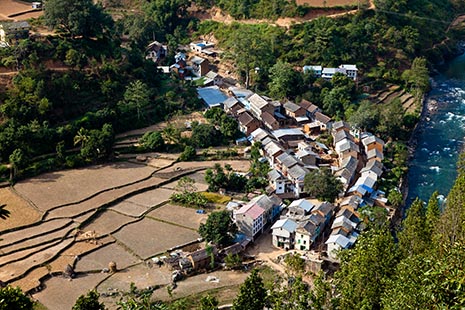
We descent to Sanghutar. It is not clear wether this name should be written with or without the letter h. We leave Okhaldhunga and enter the district of Ramechap
.... more pictures (2).
The first 5 minutes we walk uphill along a narrow street that looks like a rubbish tip, and then we reach what I take for a jeep track, judging from the fact that there is a tractor on it. The path I followed last year can be seen on the other side of the valley. In front of us lies a steep mountain ridge through which lies the shortest route from Sanghutar to Duble. That route takes about a day and a half but it is very steep. We reach Narkate Banyan at about nine. Pokari, where we camped last year, lies just a bit higher up.
I’m glad indeed when we get to Sanghutar. The lengthy descents in shoes that are just a fraction too small have resulted in my big toes being quite sore. In Sanghutar, close to the suspension bridge, we find a dry rice paddy that even with the post-harvest stubbles provides a decent place to camp.
That evening, Kame pays the men their wages and I distribute the tips. The total wages bill amounts to Rs. 75,600. If I add the expenditure on food the 30 day trek has cost me about Rs. 130,000 excluding the bonuses and what Multi will charge for support and transportation.
Ever since I met Domini Sherpa in Duble, her predicament kept occupying my mind. When saying my goodbyes to the porters, I ask her father, Kami Sherpa, whether he would like to take his daughter to Kathmandu for a medical examination if I cover the expenses. Depending on the outcome of that examination we can then decide about the what and how of any possible treatment. Any costs attached to that might be covered by me or by Stichting Milijuli. He gratefully accepts my proposal and I give him an advance on the travel expenses.
When I get back to Kathmandu I’ll do some preparatory work for this project. I’ll then go to Chitwan as planned and when I return from there I expect to find Domini in Kathmandu.
Thursday, 19-11-2009
Sanghutar - Manthali
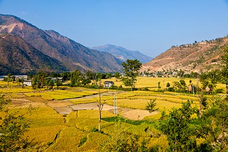
Rice paddies near Manthali.
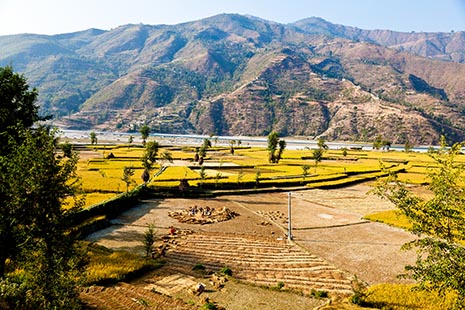
Harvesting and threshing rice.
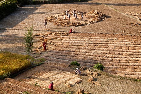
Harvesting and threshing rice.
I soon regretted the fact that I hadn’t decided to go on foot or had asked for a car to pick us up in Sanghutar. We are thrown about violently and I bump my head rather painfully against the luggage rack and nearby loudspeaker a couple of times. We hang on for dear life during the entire journey. I keep the photo backpack in my lap and hoop that my thighs provide an adequate buffer against the worst of the shocks. The EOS 5D in my day backpack is protected by a thick layer khatas in the bottom of the pack. If I could have foreseen how bad this would be I would probably have stuck to the original route to Jiri even if that would have been more difficult and a day longer.
In Manthali, Kame asks for the best hotel and has me taken to it. The room is not too bad, but the bed is so hard that I ask Kame to get my sleeping mat out of the luggage. The bathroom sports a shower but unfortunately no hot water. Furthermore, it seems that it hasn’t been cleaned since it was built. The hotel employees that I come across look a bit odd to me, so lifeless as to suggest that they are in a drug induced coma.
Kame has found himself a room in a Nepalese hotel. However, I tell him I prefer for him to take a room in my hotel even if that is a lot dearer. The one person who seems to benefit from this deal is Yangyi because now she’ll be able to watch television. But for our lunch we go to the Nepalese hotel.
After having reconnoitred Manthali with Kame and Yangyi – which didn’t take very long – and having despatched a cockroach in my room by crushing it underfoot I go for a walk by myself in the direction of the river and airport. Along the way I manage to take some pictures of a rice harvest.
During dinner, Kame introduces the chauffeur who has been sent to us by Multi Adventure. He has come with a good 4WD vehicle. This inspires confidence for tomorrow.
Friday, 20-11-2009
Manthali - Kathmandu
