
Helambu trek in 2008
22-11-2008
Jaharsingpauwa (1785m) - Chisapani (2166m)
| Start: 09:29 hour | Time: 6h30 | Up: 720m. | Down: 321m. |
| Max. altitude: 2200m at 13:18 hour, | Min. altitude: 1766m at 09:47 hour. | ||
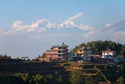
Chisapani.
At 07:20 we leave Tibet Guest House. We had planned to leave at 07:00, but the breakfast was not ready in time. In a van we drove, via Bodnath, to Jaharsingpauwa, the starting point of the trekking. The name of our porter is Naati Chata. He is approximately 25 years old. Kame Sherpa is our guide, but he gladly shares that work with Kaji Sherpa, who carries my photo backpack and video camera. We do not start in Sundarijal to avoid the climb along the thick water transport pipe, which comes down there. As from Sundarijal it is also approximately 200 meters more climbing.
It is sunny up to in the afternoon. We take several short cuts via narrow paths. As a result the shrubs scratch my arms.
In the evening we get acquainted with Simone and Erik, a Dutch doctor couple. Erik leaded a training project. Thirty years ago they have worked in Nepal and speak Nepalese. They are pleased that their daughter is doing the same now. She works in the hospital in Dhulikhel.
23-11-2008
Chisapani (2166m) - Gul Banjyang (2140m)
| Start: 07:46 hour | Time: 7h35 | Up: 822m. | Down: 823m. |
| Max. altitude: 2456m at 14:13 hour, | Min. altitude: 1715m at 08:43 hour. | ||
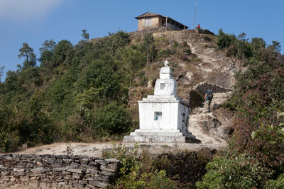
The steep parts are short.
We start with a steep descent. That was in fact not necessary, because there is also a better path, but Kame and Kaji do not know that one. The route runs via Thankuni Banjyang and Chipling.
It is sunny up to in the afternoon. In the evening we decide to deviate from the planned route to Tarkeghyang. We have noticed that it, already can become considerably cold after sunset. It makes little sense firstly to ascend to Tharepati at 3600m and descending next day to Tarkeghyang at approximately 2500m. Kaji knows a beautiful route which remains at a lower altitude. As there are no hotels along that route we will have to spend one night in a private house. We also have to accept that one of the stages will be short. Normally, Kutumsang would have been our lunching place, but now we will stay there for the night.
It is sunny up to in the afternoon. In the evening we decide to deviate from the planned route to Tarkeghyang. We have noticed that it, already can become considerably cold after sunset. It makes little sense firstly to ascend to Tharepati at 3600m and descending next day to Tarkeghyang at approximately 2500m. Kaji knows a beautiful route which remains at a lower altitude. As there are no hotels along that route we will have to spend one night in a private house. We also have to accept that one of the stages will be short. Normally, Kutumsang would have been our lunching place, but now we will stay there for the night.
24-11-2008
Gul Banjyang (2140m) - Kutumsang (2480m)
| Start: 08:20 hour | Time: 2h40 | Up: 464m. | Down: 119m. |
| Max. altitude: 2537m at 10:23 hour, | Min. altitude: 2108m at 08:20 hour. | ||
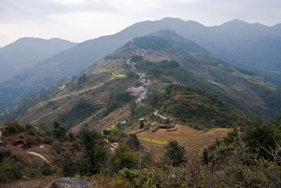
Looking back to Gul Banjyang.
On leaving Gul Banjyang we have to cope with a steep track up. Until approx. 12:40 hour it is cloudy.
In the afternoon we can explore the surroundings in nice warm sunshine.
In the afternoon we can explore the surroundings in nice warm sunshine.
25-11-2008
Kutumsang (2480m) - Guwaghang (1800m)
[The translation of ghang is hill]| Start: 07:37 hour | Time: 7h27 | Up: 417m. | Down: 1094m. |
| Max. altitude: 2532m at 08:32 hour, | Min. altitude: 1728m at 14:40 hour. | ||
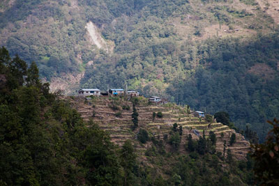
Guwaghang
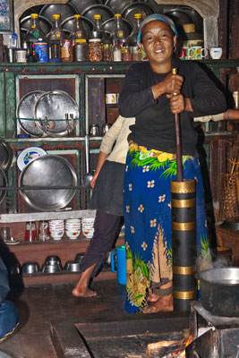
She is making our butter tea.
It was a very beautiful trip today - all day sunny.
We will stay in the house of someone who is on travel. We must, however, wait some time before we can enter, because the woman, who has the key, was still working on the fields. While waiting Naati brings sugar cane. It is the first time that I nibble it. When someone also brings freshly cooked potatoes we have an extra lunch.
At the neighbours we we dine and spend a nice evening. They are very nice people. The man chopped the chicken into parts. Not tidy legs, wings, and so on, but simply chopping with the kukuri. The bone splinters are removed during eating.
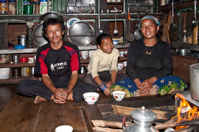

These people invited us for dinner. We also stayed for the evening.
26-11-2008
Guwaghang (1800m) - Tarkeghyang (2560m)
| Start: 07:56 hour | Time: 4h33 | Up: 983m. | Down: 237m. |
| Max. altitude: 2538m at 14:17 hour, | Min. altitude: 2371m at 12:40 hour. | ||
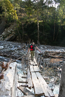
In many cases the bridges are better.
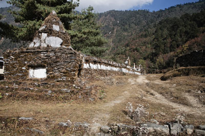
Mani wall in Tarkeghyang.
This day there are many clouds, but we also walked and rested in the sun. We start with a descent of about 200 meters, off the hillock to the river.
At the Shree Sarkatali Primary school in Dubghyang we cross that river. Thereafter we go steeply up.
I practise my advice, walk slowly and breathe deeply.
The villages we pass are Tarchung (chorten) and Timani. We have a tea pause with nice people in a private house. Anita gives balloons to a small child.
In Tarkeghyang we rent a room in the Tarkeghyang Hotel, Tourist Paradise. In 2006, I was here too. To my knowledge it is the only lodge in the village. There is hot water for a shower. In the afternoon there is sufficient time to visit the village and the gompa.
To our surprise we see arriving Erik and Simone. They had planned to go to Dhunche via the Laurebina pass, but they have changed that planning in Tharepati. They walked the route that Anita and I had planned originally. They had a couple heavy days, they got cold and Simone incurred a knee injury.
27-11-2008
Tarkeghyang (2560m) - Sermathang (2586m)
| Start: 08:29 hour | Time: 6h00 | Up: 455m. | Down: 406m. |
| Max. altitude: 2507m at 12:28 hour, | Min. altitude: 1575m at 08:35 hour. | ||
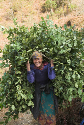
On the way home with fodder.
The afternoon pause is, as well as in 2006, at the Dolma Lodge in Ghangyuhal.
In Sermathang we choose the Mountain View Lodge. The owner is still the same. He is a diabetic and injects insulin.
The village has two gompa's. One in the centre of the village and one near a monastery, which is no longer in use and slowly goes into disrepair.
We have a beautiful sunset, which we enjoy on the terrace of our lodge.
28-11-2008
Sermathang (2586m) - Kakani (1980m)
| Start: 08:49 hour | Time: 3h20 | Up: 80m. | Down: 693m. |
| Max. altitude: 2520m at 08:56 hour, | Min. altitude: 1903m at 12:09 hour. | ||
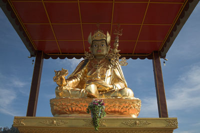
Golden statue of Guru Rinpoche.
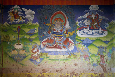
Wall painting at the entrance of the gompa in Kakani.
Under way, we come along a large gild statue of Guru Rinpoche, which is placed on a hillock. Behind the statue you see, between two mountain backs, a snow covered mountain. Studying the map we decide that the name of that mountain should be Gangchhenpo, but I would not be surprised if it nevertheless is Langtang Lirung.
The statue of Guru Rinpoche has been made in Delhi and was transported, by air, to this place. During this transport the eyes were covered. The eyes were uncovered during an inauguration ceremony, in 2008.
It has been entirely paid for by a Nepalese, living in America.
Just as beyond Guru Rinpoche I miss a part from the GPS track. The batteries were empty. Fortunately it was no real interesting part - a Jeep track.
When we see a long row chorten, for the memory of deceasedes, that brings the conversation on cremations. For a cremation, at least 300 kilos wood are necessary. That is then generally more than one tree. Wood costs 10 rupees per kilo, in Kathmandu.
In Kakani we rent a room in the Everest Guest House. With Simone we visit the gompa.
After dinner the guide of Erik and Simone gives an anniversary party. There is a cake, he treats on beer and of course we dance on the music.
29-11-2008
Kakani (1980m) - Melamchi Pul Bazar (826m)
[by bus from Melamchi to Dhulilhel (1510m)]| Start: 07:57 hour | Time: 2h39 | Up: 35m. | Down: 1200m. |
| Max. altitude: 1893m at 07:57 hour, | Min. altitude: 797m at 10:27 hour. | ||
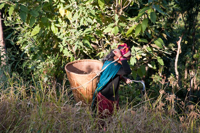
Harvesting millet.
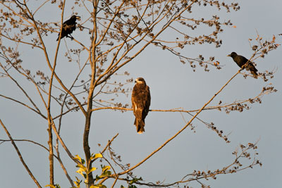
Black kite (?).
We walk against the sun. For good views you must look back.
We encounter many people, who go to a wedding. They are wearing their most beautiful clothes. Taking pictures of them is difficult because of the strong back-light.
Under way I learn a little bit about agriculture. Wheat is cultivated as well as rice with water on the land. That method one calls KEP (with water). Dry agriculture one calls BARI. Therefore millet and corn are grown bari, rice kep and wheat bari or kep.
In Melamchi Pul Bazar a car (4-WD) is waiting for Simone and Erik.
We go with the bus to Dhulikhel. The way was longer than I expected. We rent rooms in the Dhulikhel Hotel. I have been there before.
I love it to have a hot shower again and to sit in the sun with a bottle of beer.
The altitude measurements of the route data come from my watch (Suunto X6hr).
In Chisapani the difference between GPS-altitude and the barometer altitude of the watch was less than 5 meters. Since then I did not compare the both.
At the places where we stayed for the night the altitude was measured with a GPS.
In Chisapani the difference between GPS-altitude and the barometer altitude of the watch was less than 5 meters. Since then I did not compare the both.
At the places where we stayed for the night the altitude was measured with a GPS.
More important are the number of meters going up and the number of meters going down. For a trekking, where no problems with altitude are expected, the absolute altitude is not so important
30-11-2008
Excursion to Namobuddha
[For the night we stay in Dhulikhel].
Himalayas, as seen from Namobuddha.
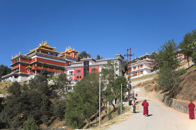
Namobuddha monastery.
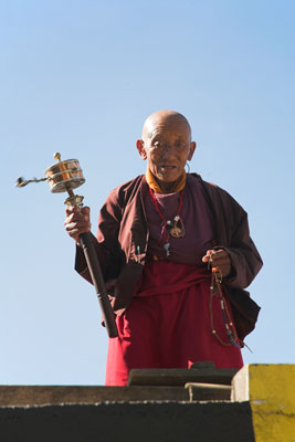
Monk of the Namobuddha monastery.
Namobuddha is a Buddhist pilgrimage place. On the hill is a beautiful monastery.
It is too far from Dhulikhel for a one-day walk. For this reason you take a bus for the first part. From the bus stop it is two hours walking through the woods and some villages. However, now there is each hour a bus driving the detour to Namobuddha and we were happy to catch that one. We appreciated the two extra hours at the place.
I had been already at Namobuddha in 2005. Then, the monks were working hard at the construction of the buildings and at the decoration of the buildings. Another group was rehearsing dances. It was, like frequently, no clear weather. I was eager to know what I would see this time.
It was really much more beautiful than I expected. Moreover, it was now exceptionally clear weather. As from the North side of the monastery complex and as from the hill just further than the monastery you could see a complete range of high mountains. I must still check it, but I think that you could see the complete range from Everest to the Annapurnas.
The monks were still constructing buildings to extend the monastery complex. The finished buildings were splendid. I think that one was now mainly working at extending with living accommodation and tourist facilities.
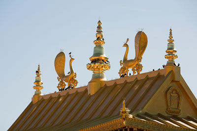

Roof ornaments
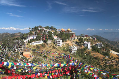
Namobuddha, as seen from the hill near the monastery
01-12-2008